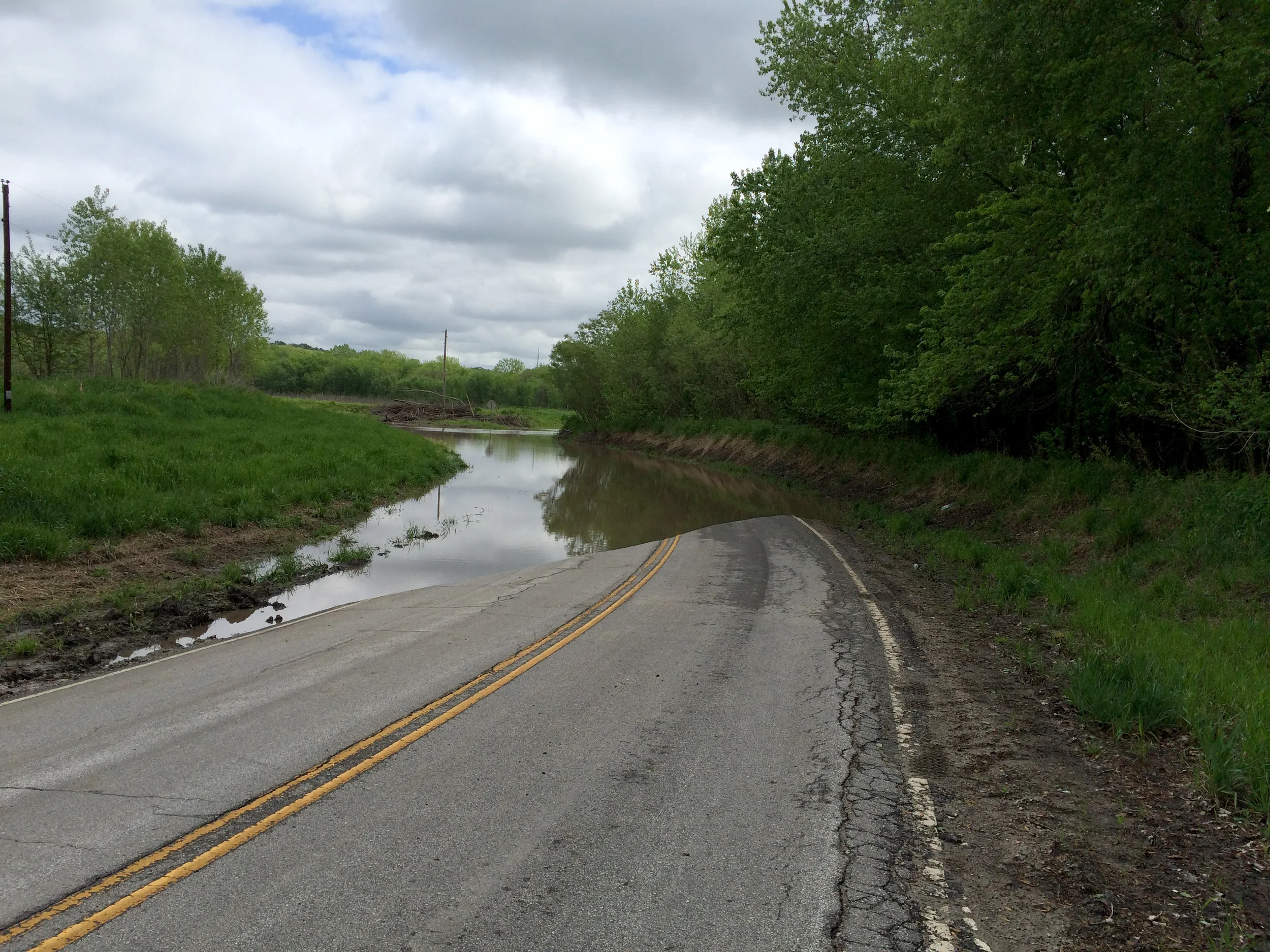
As last week’s storms forced the National Weather Service to extend their flood warning for the area to Thursday, May 5, life had already returned to normal for most of Platte County following last week’s major rain events in the area.
Record levels of precipitation were recorded at KCI Airport during a period of six days with consistent rain. That included 3.65 inches measured on Tuesday, April 26, well more than the previous high mark of 1.85 inches from 2009.
By Sunday, May 1, KCI’s precipitation measurement for the year stood at 11.03 inches — about 2¼ more than average for this point in the year. The Platte and Missouri rivers both passed flood stage and are expected to remain there until Thursday, but damages were limited and inconveniences were minor for local residents.
“The people that have been here 10, 20 years understand that the river comes up and goes down pretty frequently,” Platte County director of public works Greg Sager said.
In relation to storms and flooding, Sager’s office monitors and repairs roads and bridges, manages road closures and handles the cleaning of roads after storms.
Last week’s rain event led to only localized flash flooding, and road closures in Platte City were limited to Highway E east of Camden Point, which opened back up late last week. The Platte River at Sharps Station reached a crest of 31.91 feet on Saturday, April 30 and remained at moderate flooding levels as of The Citizen’s deadline.
The flood stage for that part of the river is 21 feet with forecasts calling for it to go back below that level on Wednesday, May 4.
In Tracy, the Platte River reached a crest of 26.6 feet on Sunday, May 1 but stayed well below the major flood level of 29 feet. By Tuesday, May 3, the river was back in minor flood levels and expected to return below the flood stage of 17 feet by Wednesday, as well.
“The slow (river) rise that we get from long-duration rains is easier to manage because you can plan for it coming to some degree and keep people relatively safe,” Sager said. “What’s bad is when we have physical dangers from wind and lightning and tornadoes or an extremely large amount of water falls at one time and creates flash flooding. Those are the one’s we’re a little more concerned with because those are more dangerous to the traveling public.”
Although Sager’s team is busy cleaning up silt deposits and tree limbs left from the river creeping onto roads, he trusts the preparations that local governments have taken.
Platte City city administrator DJ Gehrt oversees calls about downed trees, power outages and basement floods. However, last week’s steady rains did not lead to any calls about damages.
According to Gehrt, the city works regularly with KCP&L and Platte-Clay Electric Cooperative to trim trees near power lines, and regular maintenance to the sewer system has helped prepare for major rain events like last week.
“We have a tremendous amount of storm-water retention when it’s needed,” Gehrt said, “but even in these big storms we’ve had the past couple of days, it hasn’t even reached those levels of use.”
Sager also stressed the importance of storm safety for residents. This likely won’t be the last flood event of the year, so remembering how to handle emergencies can prevent bigger issues.
“Do not drive through flood waters,” Sager says. “There could be obstructions or potholes or sinkholes or the soft shoulder that doesn’t support the weight of the vehicle.”


